Knobstone Trail 101: Indiana's Longest Footpath
In 1973, the Indiana Department of Natural Resources tasked a young University of Oregon graduate, Jerry Pagac, with creating a long-distance hiking trail along the stark bluffs and ravines of an escarpment rock formation in Southern Indiana that featured round-topped hills, or “knobs.” The result: Indiana’s lengthiest footpath, stretching across 58 miles of the state’s roughest terrain and two state forests—from Deam Lake State Recreation Center in Borden to Delaney Park in Salem.
Avid hikers often use the Knobstone to warm up for longer hikes along the Appalachian Trail—even calling it “the little AT.” But if you’d like an easier introduction, these three day hikes will do the trick. Gird your glutes!
Delaney Park Loop
6 miles / Moderate
Consider this section Knobstone’s Choose Your Own Adventure area, where you can shorten our suggested route to a quick two-mile jaunt or extend it to a nine-mile circuit past Spurgeon Hollow Lake. The six-mile loop, however, will take you around logging operations (and consequently, the trail is sometimes rerouted). Dotted with patches of greenbrier and waterbars, this region features a mix of flat footpaths and inclines, too. After mile marker 42d, you can catch picturesque views of the forest thanks to thin trees and fall colors. Near Spurgeon Hollow, you will contend with narrow sections of the trail that are often dense and overgrown.

Leota to Elk Creek Lake
7 miles / Rugged
Here, you’ll start your hike near a picturesque valley but will quickly ascend 850 feet above the nearby town of Leota. Next, you’ll enter the trail’s backcountry and some of its most challenging terrain, including steep uphill climbs and switchbacks. For most of the rest of the hike, you’ll trudge under a deep canopy of chestnut oaks as the dirt trail snakes through a dry creekbed, thinning to only a foot wide in some places, with a 60-degree-or-so drop between knobs. At mile marker 32, your sylvan toiling pays off with a stunning, foliage-framed view of Elk Creek Lake.

Deam Lake Trailhead to Mile Marker 10
10 miles / Rugged
Start your trek at Deam Lake, the Knobstone’s southern terminus. From there, serpentine paths and moderate terrain get the blood flowing. At mile marker 4, the trail tapers atop Bartle Knob, where you can catch your breath, grab a snack, and enjoy autumnal views of Blue Lick below. Just feet from mile marker 6 stands a rock formation carved with the initials of Hoosier hikers dating back to 1896. Steps off the trail, just up a hill to the north, rises Round Knob, one of the footpath’s highest marks. Mile marker 10 provides a panoramic vista of Louisville—a sight that will make you forget your aching legs.

Coming Soon Plans are afoot to triple the Knobstone’s length by connecting it to the Tecumseh Trail south of Martinsville, extending Knobstone to 150 miles. The Knobstone Hiking Trail Association, which is working with property-owners to get easements for portions passing over private land, is aiming for a 2016 completion.
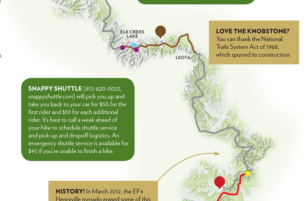
Love the Knobstone? You can thank the National Trails System Act of 1968, which spurred its construction.
Snappy Shuttle (812-620-0023, snappyshuttle.com) will pick you up and take you back to your car for $50 for the first rider and $10 for each additional rider. It’s best to call a week ahead of your hike to schedule shuttle service and pick-up and dropoff logistics. An emergency shuttle service is available for $45 if you’re unable to finish a hike.
History! In March 2012, the EF4 Henryville tornado erased some of this section’s most scenic and canopied views, flattening a sea of trees in Clark State Forest. You can still observe the damage—and slow recovery—today.
Takealong The path’s quintessential guidebook, A Guide to the Knobstone Trail: Indiana’s Longest Footpath, by Louisville naturalist Nathan D. Strange (Indiana University Press, $9.98)
Beware! Hunting allowed—wear orange
Campsites nearby
Steady cell-phone service


